
Intro: this is my guide to my favourite walk with an option to see Rydal Cave included. The car park in Ambleside and cave can get busy, so aim to do this as early as possible, a good start time is 9am, so that you can get to Grasmere just as the pubs open!
Distance: 5.3 miles
Duration: 2-3 hours depending on stops
Difficulty: childs play, very easy on mainly flat surfaces including tarmac, one option easy climb up to Rydal Cave.
Suitability: not suitable for buggys, mobility scooters or wheelchair users due to one section being rocky
What to see: Rydal Cave, Rydal Water, Grasmere ‘lake’, Grasmere village, woods, a beach, possible military jets, various birds and wildlife including deer and red squirrels
Fun bonus fact 1: there is only 1 lake in the Lake District, Bassenthwaite Lake, all the others are ‘mere’, ‘water’ or ‘tarns’. However, for simplicity, areas like Grasmere (which is both the lake and village) normally will add the ‘lake’ name for the actual lake, eg ‘Grasmere Lake’.
Fun bonus fact 2: The village of Windermere is separated from Windermere ‘lake’ by the town of Bowness (aka Bowness on Windermere). So if you are going to either, make sure you define which one you are going to as it’s separated by a good 20 minutes down a steep hill (30 minutes up!).
Route (click to enlarge):
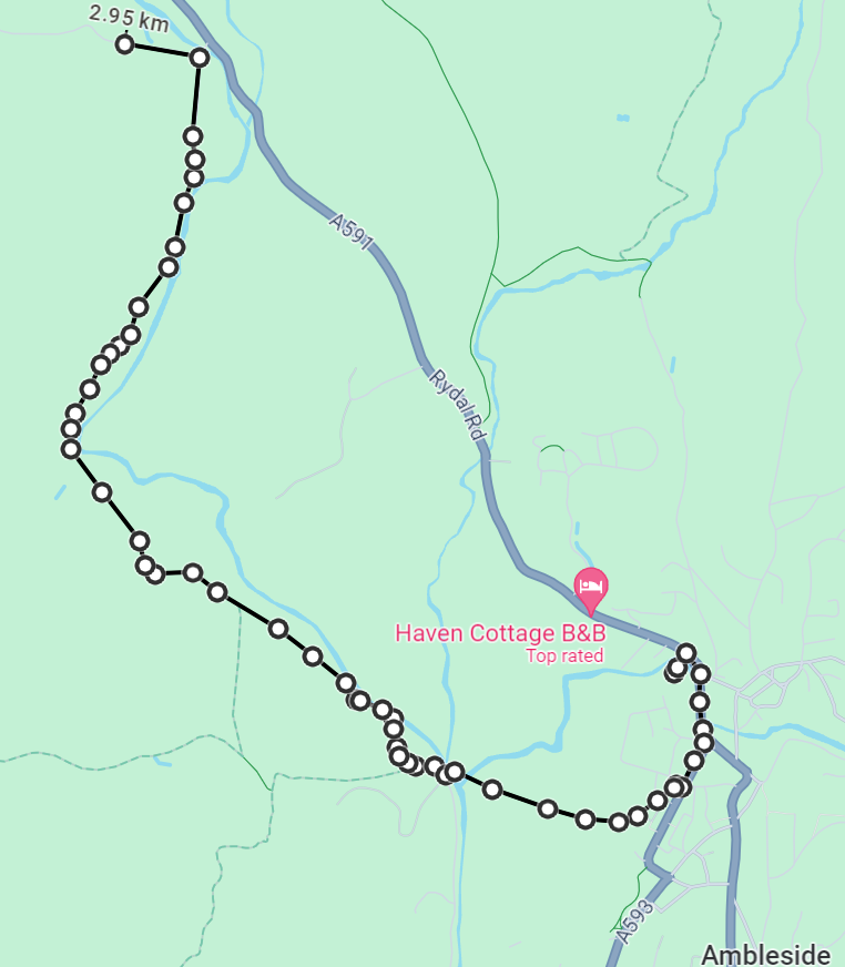
Stage 1 – Ambleside to Pelter Brdige Car Park – 3 km (1.8 miles)
Don’t miss this part out, otherwise, you will miss the beautiful fells as you walk along the river and you will also miss crossing the stepping stones if you dare!
Starting in Ambleside you can park in any of the car parks, but I’d go for the Rydal Road Car Park just north of Ambleside centre. Once parked you can have a quick look at the Bridge House which had many uses over the years, but you can wonder how on earth it was once a house for 8 (yes, eight) people!
Follow the road from the Bridge House south, keeping on the right-hand side past the Co-op until you get to the vegetarian restaurant Zeffirellis. From here beside the chippy, you will want to take Vicarage Lane towards the church in the distance. Go past the church on your left and the school on your right and follow the path directly in front of you through Rothay Park.
After a few minutes you will come to a set of standing stones on the left, ahead on the right is a little metal bridge ahead which leads you to cross over a nice stone bridge. Once over, there is a signpost showing that Grasmere is 5 miles away and other destinations. Go right after crossing the bridge, go through the gate by the cattle grid and follow the road taking views of the fells on your right while walking along the riverside.
Follow this road for about a mile until you get to the very modern building on your left (which are expensive holiday homes) and immediately after it on the right you should be able to see some stepping stones as the water nears the path. Cross if you feel like being daring, which I have done a few times!
Once you are done with crossing over and crossing back, you need to continue on the same road which will open out into a field with possibly the famous Herdwick sheep around, keep on going and you should see a bridge ahead. Do not cross this bridge, instead, turn left and go up the path to the car park and you have completed stage 1.
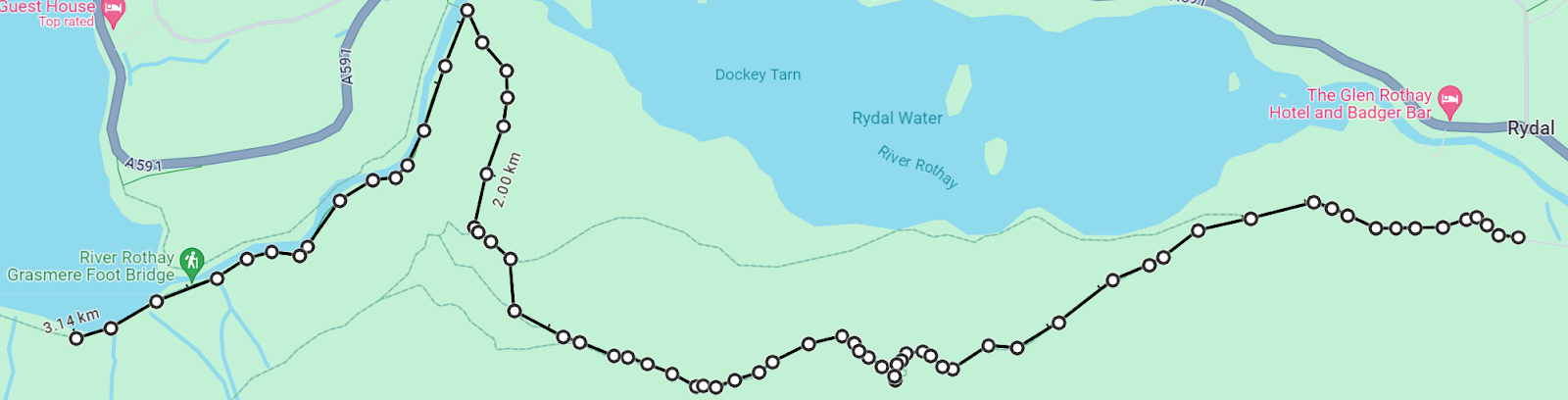
Stage 2 – Pelter Bridge Car Park to Grasmere Beach – 3.1km (1.9 miles)
At the car park continue up the hill along the path past a wedding venue on the right and some isolated cottages to your left. This path then goes down until you come to another gate and cattle grid. Go through and you will come out to Rydal water which looks lovely in the sunshine! From here you can a) carry along the water edge or b) go up to the cave. Doing a) is very easy as you just follow the lake around until you get to the abandoned building and turn right into the woods through the gate. Doing b) is up to the cave, which I’m assuming that’s your plan.
So taking the left fork you start to ascend the climb up to the caves. The caves are about 700 metres away and the path curves to the right before curving back left to the cave entrance. There are also some little caves just before reaching the main cave, these are hard to navigate and I would not recommend jumping down to get to them. The main cave is easily accessed, and you should hope that nobody is about so you can get some nice pictures.
Once finished with the cave, exit left and continue a slow descent along the path for another 700 meters or so until you get to a path that looks like it’s heading for some woods with a wooden gate and to the right of the woods, you might be able to see an abandoned building. This is your destination, so make your way down to the beginning of the woods and go through the gate. Follow the twisting path through the woods till you get to the bottom of the hill. Upon reaching the bottom you will be able to see a bridge ahead. Do not cross the bridge, instead turn left and follow the path along the river.
This path will lead you through the woods, quite close to the river and the path can get narrow. You pass a nice little area by a set of small waterfalls where you can rest and paddle in the water if you want or just continue following the river. In a little while you will come out of the woods to a little gate turning right, and beyond lies the difficult part of the walk which unfortunately makes it inaccessible for wheelchair users.
You can stop here for a bit, as I tend to do and take in the lovely river flowing through this section where the woods and the mountains edge start. This is the bit where concentration is paramount, the path is very uneven, rocky and slippery. I have seen people slip on this and hurt themselves, however, the good news is that it’s only 200 meters in length before back to normal.
After you have finished that short section, you should come to another bridge on the right. Again don’t cross this bridge instead walk ahead and you will come out to a beach-like area and Grasmere ‘lake’. You have completed stage 2.
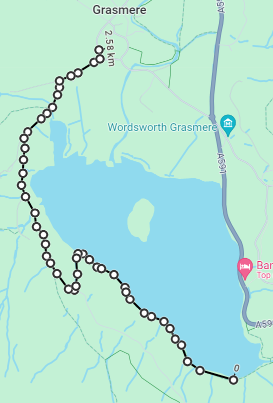
Stage 3 – Grasmere beach to Tweedies Bar (Grasmere) – 2.5km (1.6 miles)
Not much to this section, you really can’t get lost as it’s just following and keeping to the right.
Finishing at the beach you should be able to follow the path alongside the ‘lake’ edge keeping close to the lake. This is a very easy route through the woods and then along the path with hills to the left with the lake to the right. Eventually, you will come to a bit of a left turn including a short climb up to the road to Grasmere. Once up and through the gate at the top turn right and you will follow the road to the village.
Keep an eye on the walls as there are deer in the woods and just looking over once I surprised one about two feet away. After a while, you will get to a place called Fareyland where you can stop for a coffee, ice cream, take a boat out if the weather is good and relax by the water’s edge.
Otherwise continue onward towards Grasmere village, you will come to a ‘T’ junction and turn right past the hotel called Grand at Grasmere, which is the start of the village. From here you can do any number of things, but I would suggest a pint (non-alchy of course!) is in order so by the car park on your right go left, up the small road and enter Tweedies bar which also does nice food.